Pepper Arden is a predominantly 19th century park and garden but with important designed landscapes dating from previous periods. The first main house, now Temple Farm, was located in the northern part and had associated gardens created in the 17th century or possibly earlier. A new Hall was built in the second quarter of the 18th century in the southern section with walled gardens, orchards and formal avenues. The southern park, lodge and new walled gardens, with their unusual serpentine or crinkle-crankle walls, were in-situ by 1850. By 1893, the gardens next to the house had been laid out and the park extended north to a new East Lodge in the village of East Cowton.
The Pepper Arden estate was divided between the manor of ‘Temple Towton’ that was granted to the Knights of the Temple in the 13th century and part of the manor of South Cowton (Figure 1). The Knights Templar lost their lands at the Dissolution and in 1568 they were granted to Percival Bowes and John Moysier. The lands were then acquired by Sir Cuthbert Pepper, as on the 27 April 1583 the following was issued:
BOND. Cuthbert Pepper to Richard Teasdall. Re Grange "Temple Cowton" within Wrythley with appurts and other lands. Details re taking possession, and attornment of tenant (LULSC YAS MD178 108)
At his death in 1608, Pepper held the capital messuage of Temple Cowton with 180 acres of land then held for life by Dame Margaret Dakyns (VCH 1914).
South Cowton manor was in the possession of the Conyers family who built Cowton Castle in the late 15th century. With Sir Robert Bowes’ marriage to Margaret Conyers in 1523, it became the property of the Bowes family. Part of the manor was acquired by the Pepper family to form the southern portion of the estate. It may have been the land sold to Cuthbert Pepper in 1567 when he bought seven-eighths of a messuage from Sir George Bowes of South Cowton (VCH 1914).
On the 1 Oct 1668, there was the following agreement:
Between Thomas Pepper of Temple Cowton, Gent and Leonard Robinson of Kirkeby Ravensworth 1st: Leonard Smelt of Kirkeby Fletham and Christopher Wastell of Fencote, Gent, Other. For diverse good causes, confirm to Leonard Smelt and Chris. Wastell, Capital Messuage in Temple Cowton wherein Thomas Pepper nowe dwelleth, and all those messuages, tenements or farmshoulds whatsoever in Temple Cowton and South Cowton now or late in tenure Thos. Pepper with etc. etc. to the use of Thos Pepper and Susanna his wife, for and duringe their natural lives and the life of the longer liver of them (ref, to Joynture, dower, and issue). In default of issue to right heirs of Thos Pepper. For ever. (LULSC YAS MD178 126).
In the 1673 hearth tax survey, Thomas Pepper was listed as having 11 hearths in South Cowton. The 1718 map only shows a significant property to the north, later called ‘Temple House’ and possibly was the Knights Templar medieval manor house. It was built next to a court, with orchards to the north and south (Figure 2). Thomas was buried at Kirkby Fleetham in 1680 and described as the ‘great-grandson of Sir Cuthbert Pepper’. It is not known whether Cuthbert, who owned the estate in 1718 when the map was drawn up, was Thomas’ son or another relation. Cuthbert died 2 years later and left his property to his only son, Prescott (b c. 1709).
In 1743 Prescott Pepper died without issue and left Pepper Hall to his sister, Sarah, wife of John Arden. A map of 1754 (CALS DAR L1) shows a substantial mansion erected between 1719 and 1742. The Ardens moved there from their Cheshire property around 1754. At this stage, most of the later parkland was fields and the estate covered just over 362 acres. However there are two avenues leading from the house, an enclosed garden to the northeast and gardens (possibly orchards) to the northwest (Figure 3).
John Arden died in 1787 and the estate was inherited by his son, also John. When he died childless in 1823, it was his nephew, Richard Pepper Arden, who inherited Pepper Hall. By 1854 and the 1st edition OS map, the southern section around Pepper Hall had been converted to parkland, a lodge had been built next to the road leading to North Cowton and also a substantial series of walled gardens with associated buildings (probably glasshouses) was in place.
There is an entry in William Andrews Nesfield’s ‘county map’ for Pepper Arden. No details are given as to the commission or the date but the client was Lord Alvanley, so it must be before 1857 (Evans 2007, 51). In 1850 the architect, William Burn, was commissioned to make alterations to the house (http://www.scottisharchitects.org.uk/building_full.php?id=421110, accessed 28 October 2016). He had collaborated with Nesfield on other projects, so it is possible this is when the work, if carried out, was done on the gardens.
With the death of the 3rd Baron Alvanley (Richard Pepper Arden) in 1857, the estate was sold to William Frederick Webb, who owned other parts of South Cowton and East Cowton (he was a descendant of Sir John Webb 5th Bt). Webb acquired Newstead Abbey and moved there in 1861, selling Pepper Hall and its estate to Henry Hood for £100,000 (Morning Post, 14 June 1861). Hood made substantial improvements to the buildings and the surrounding lands, adding the new stable block and ‘model farm’.
The mansion, immediate gardens, parkland, Home Farm and Temple Farm were sold by Hood’s heirs in 1882 to William Stobart (Northern Echo, 28 November 1881 & NAS ZSA 50/81). The rest of the wider estate of nearly 2000 acres was split into 24 lots and put up for sale separately (The York Herald, 7 September 1881). During Stobart’s tenure, it is thought that the park was extended to East Cowton village and the East Lodge added. Stobart died in 1905 and in the sale catalogue (NAS ZSA 50/81) of that year, the estate covered 373 acres with the Mansion and pleasure grounds covering just over 16 acres. There is a contemporary description from that year:
‘A short path and stile brought me out into Pepper Arden Park, of 235 acres, which extends southerly for nearly a mile and a half from the lodge gates in East Cowton village to the Northallerton road. A carriage drive runs the entire length, and gracefully mounts from a green pasture near the old castle to a belt of fine ancestral trees surrounding the modernised hall…The original building bore many traces of troublous times, even to its secret staircases in the thickness of the walls; but it has been entirely rebuilt as a modern mansion, with fine stables &c, for which William Stobart Esq. of Sunderland, gave some £40,000. The Hall stands well in its park of 235 acres, its lofty and ornamental western tower acting as a landmark, and dominating a good hunting country. There is some fine timber about the house, but quite insufficient covert on the estate for pheasants. The pleasure-grounds are pretty extensive. Since Mr Stobart died at a ripe old age in June last, the place has been in the market’. (Leeds Mercury, 2 December 1905)
Pepper Arden was once again put up for sale in 1910 (The Evening News, 4 January 1911). The sale catalogue gives the following description:
One of choicest positions in a purely pastoral, undulating and well-timbered country. It comprises a Substantially-built Mansion House in the EARLY VICTORIAN style of Architecture, approached by two Carriage Drives from the North and South sides of the Estate respectively.
The North Drive is entered from the Village of East Cowton, and is protected by a pair of imposing Entrance Gates, and LODGE standing in a pretty Garden. This Drive traverses a beautifully timbered and undulating Park for the distance of about a mile, when it enters an Ornamental Plantation sheltering the House on the North side.
The South Drive is entered from the Darlington and Northallerton High Road, and is also guarded by a pair of Iron Gates, with Wicket Gates and curved flank walls on either side; adjoining, in an Ornamental Plantation is a Picturesque Lodge.
The Mansion stands on a knoll within the Park, and commands from the upper floor on the East side enchanting views of the Cleveland Hills, and on the West side of the Richmond Hills and the lovely landscape beyond…
The Lovely Gardens and Pleasure Grounds are fully matured and are exceedingly beautiful, but at the same time are comparatively inexpensive to maintain. On the main front is a Terrace Lawn from which flights of stone steps descend to the Rosery Avenue; and on the South and South-East front, also approached by a Terraced Walk, passing round the South and West sides of the Building, is a Series of Tennis and Croquet Lawns traversed by sloping paths and walks which lead to the Gardens; the Lawns are bordered and overspread by a rare collection of Coniferae and other specimen Ornamental Trees, and are parted from the Park by an ornamental dwarf wall with a sunken ditch on the outside; on the North side, the Grounds and Residence are sheltered by a lofty collection of fine old Forest Trees.
In the South corner of the Lawns is a Prettily Disposed Parterre Flower Garden, and below this, and surrounded by high walls, is An Old English Flower Garden, having at the side and end a lean-to Peach House and Vinery; a second double lean-to Grapery, containing Black Hambro and Muscat Vines, respectively; a corner Fernery, lined with rockery work; a Fern Display House and a Stove House; whilst at the end is a set of nine Tomato Pits. Beyond is The Middle Fruit Garden, having at the side an Orchid House and a double-span Tomato House; and at the South of this is a Highly productive Kitchen Garden containing a Peach House and an ancient Sun Dial.
It was acquired by Geraldine, Lady Chermside (daughter of William Frederick Webb) but with her death later that year, the estate passed to her husband. When Sir Herbert Chermside died in 1929, it became the property of his second wife for her lifetime and then in trust to his niece, Katherine Gatty (neé Morrison) and her descendants (The Yorkshire Post, 11 December 1929).
Pepper Arden lies in the parish of South Cowton, about 10km (6.5 miles) north-west of Northallerton. The historic estate covered 151ha (373 acres) and the waterway, The Stell, forms its northern boundary until past Temple Farm when it continues to the main road through East Cowton. The Stell also forms the eastern boundary until NZ 304 025, thereafter the boundaries in the southern section are marked by the ‘The Belt’ Plantations. The western boundary is marked by the banks to the west of ‘Pepper Arden Bottoms’, an area of water meadow (Figure 3).
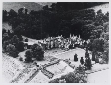
The Hall sits at 61m AOD at a slightly elevated position to the surrounding parkland to the north that lies between 47 and 52m. There are two main entrances: East Lodge in the village of East Cowton and South Lodge. The latter’s gate piers, gates, railings and walls are listed Grade II and believed to date from the late 18th century. The carriageway from the East Lodge runs through the northern section of the park to the stable complex. The drive from the South Lodge goes to the front of the house.
The main house, Pepper Arden, is listed Grade II with the Historic England entry noting that the central block is early 18th century, the rear wing c1850 and the side block and canted bays c. 1870. It suggests that the 19th century alterations were possibly by William Eden Nesfield, the architect son of William Andrews. The stables approximately 100 metres to northwest of the house and the Italianate water tower are also listed Grade II and date from the late 19th century.
The early gardens shown on the 1754 map (Figure 4) had been removed by 1850 (NYRCO MIC 1791/112) with pleasure grounds to the west and a series of new walled gardens to the north east (Figure 5). These had a number of glasshouses and by 1861 these apparently had a fine collection of plants judging by the following advert, which put them up for sale:
‘The extraordinary fine and large collection of rare and choice specimens of stove and greenhouse plants (allowed to be the finest collection in the North of England)’ (The Durham Advertiser, 24 May 1861).
With the alterations by Henry Hood to the main building after 1861, the pleasure gardens were remodelled with possible further additions by Stobart before 1891 when the survey for the 1:2,500 OS map was conducted. This shows a series of gardens to the north and east of the Hall, which included a croquet lawn, tennis court, rosery avenue, parterre garden and lawns.
The existing walled garden is separated into four sections and covers about 2.8 ha (7 acres) (Figure 6). On the west is the ‘Old English Flower Garden’ with a range of glasshouses. To the east of it is the ‘Middle Fruit Garden’ with more glasshouses and the kitchen garden, which is divided into two sections. The larger of the two has another glasshouse and a sundial in the middle. The three latter areas have unusual walls being serpentine in construction. This type of wall was popular after the introduction of the Brick Tax in 1784, as they reduced the number of bricks required and many were built at the start of the 19th century (Campbell 2005, 56-57). The date of the walled garden is unknown but before 1850.
The original park of about 61 ha (150 acres), created before 1850, is surrounded by a series of plantations known as ‘The Belt’, with a larger wooded area ‘Thistle Wood’ to the north east. This was extended to the north in the late 19th century to include a further 25 ha (62 acres) and included the unusual shaped ‘Star Plantation’ that is no longer extant.
Books and articles
Campbell, S. 2005. A History of Kitchen Gardening. London: Frances Lincoln.
Evans, S. R. 2007. William Andrews Nesfield [1794-1881] Landscape Gardener Volume 2, PhD thesis, University of Plymouth
Victoria County History [VCH] 1914. 'Parishes: East Cowton', in A History of the County of York North Riding: Volume 1, ed. William Page (London), pp. 160-162. British History Online http://www.british-history.ac.uk/vch/yorks/north/vol1/pp160-162 [accessed 14 October 2016].
Primary sources
Cheshire Archives and Local Studies (CALS)
DAR/L/1 A Plan of John Arderne Esq.'s Estate called Temple Cowton and South Cowton alias Pepper Hall in the North Riding of Yorkshire, 1754
North Yorkshire County Record Office (NYCRO)
ZDG(A) XIV/4 [MIC 1523] An Exact Survey and Mapp of Temple Cowton and South Cowton in the County of Yorke taken for Cuthbert Pepper Esq in the Year 1718 by John Nesham
MIC 1791/112 Tithe map of South Cowton, 1850
Northumberland Archives Service (NAS)
ZSA 50/81 Sale catalogue for Pepper Arden Estate, Yorkshire, 11/10/1905
Private collection
Sale catalogue for Pepper Arden Estate, Yorkshire, c1910
Leeds University Library Special Collections (LULSC)
Yorkshire Archaeological Society (YAS)
MD178/108 Bond between Cuthbert Pepper and Richard Teasdall, 1583
MD178/126 Agreement between Thomas Pepper and others, 1668
Newspapers
Leeds Mercury
Morning Post
Northern Echo
The Durham Advertiser
The Evening News
The Yorkshire Post
Maps
Ordnance Survey 6” 1st edition, surveyed 1854, published 1857
Ordnance Survey 6” 2nd edition, surveyed 1891, published 1895
Ordnance Survey 6” Rev edition, surveyed 1912, published 1919
Ordnance Survey 25”, published 1893
Ordnance Survey 25”, published 1913
Figure 1 – Estate in 1718, redrawn from map (NYCRO ZDG(A) XIV/4)
Figure 2 – Detail of Temple Cowton manor house and gardens from map shown in Figure 1 (NYCRO ZDG(A) XIV/4). Blue line indicates boundary of Temple Cowton manor
Figure 3 – Pepper Hall estate from OS Rev edition 6” map (surveyed 1912, published 1919). Reproduced by permission of the National Library of Scotland.
Figure 4 – Pepper Hall and gardens redrawn from the 1754 estate map (CALS DAR/L/1)
Figure 5 – Pepper Hall and gardens from 1st edition 6” map (surveyed 1854). Reproduced by permission of the National Library of Scotland.
Figure 6 – Pepper Arden kitchen and walled gardens redrawn from OS 25” map published 1893
. Used with permission of North Yorkshire County Record Office")
 XIV/4)")
 XIV/4). Blue line indicates boundary of Temple Cowton manor")
. Reproduced by permission of the National Library of Scotland.")
")
. Reproduced by permission of the National Library of Scotland.")
